HDS 3D Laser Scanning & Modelling
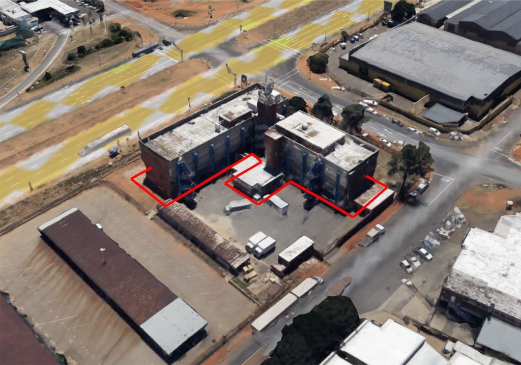
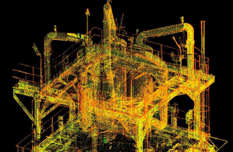
High-Definition Surveying (HDS) is a precise, laser scanning method used to capture detailed 3D measurements of buildings, infrastructure, and terrain — both indoors and outdoors. Using terrestrial laser scanners, we scan multiple positions to generate millions of data points, known as a point cloud.
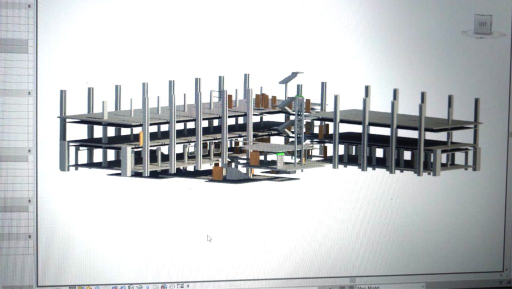
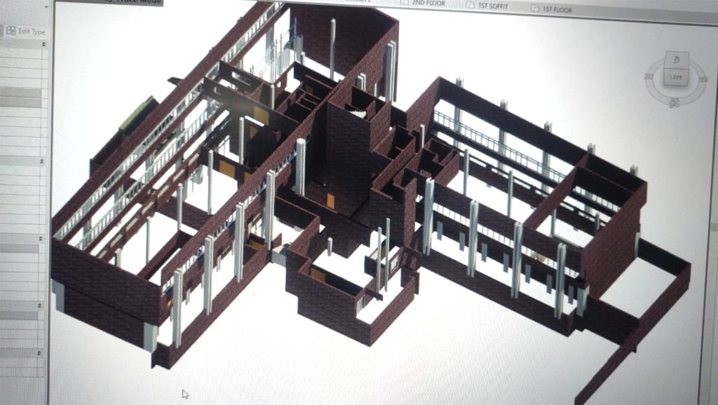
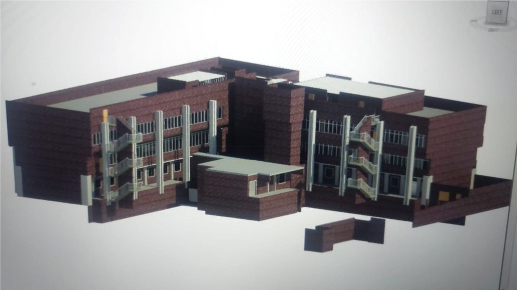
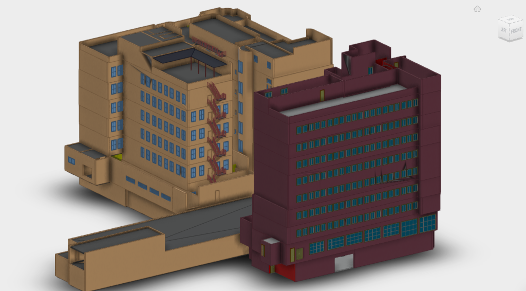
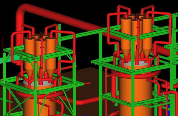
These point clouds are stitched together, cleaned, and used to build highly accurate 3D models and as-built plans. The technology captures everything the laser can “see,” including walls, doors, ceilings, HVAC systems, piping, and fixtures. From these scans, we create DWG CAD layout drawings, 3D BIM or Revit models, and even 360° panoramic photos.

Whether you need plans recreated from scratch, want to verify structural layouts, or require measurements for renovations or engineering projects — HDS delivers fast, accurate results. We scan in both local and geographical coordinate systems, using Hartebeesthoek94 (Lo zones) or UTM, depending on your site requirements.
Applications
- As-built recreation / Digital twin
- Renovation & structural alterations
- BIM & Revit modelling
- Volume calculations, tunnels, and mines
- Powerlines, plant layout, and road infrastructure
Deliverables
- Cleaned point cloud data
- DWG CAD drawings
- 3D Digital twin models in AutoCAD, Revit, or Cyclone
- 360° site photos and interactive viewing
- Survey reports for reference or submission
With various levels of modelling detail (LOD200 to LOD400), we tailor each scan to your project needs — from schematic engineering layouts to detailed architectural design ready models, view our gallery below of model samples.