<script>
function gtag_report_conversion(url) {
var callback = function () {
if (typeof(url) != ‘undefined’) {
window.location = url;
}
};
gtag(‘event’, ‘conversion’, {
‘send_to’: ‘AW-17476637861/h64YCI_p7ZscEKWpwY1B’,
‘event_callback’: callback
});
return false;
}
</script>
3D Concrete Scanning & Reporting
Concrete scanning uses GPR ground-penetrating radar and other equipment to detect materials or voids within a concrete.
Advanced Scanning Solutions (Pty) Ltd are experts in the field of concrete scanning, providing our clients with precise information regarding the structure, strength and composition of the structures as well as locating all conduits hidden within the concrete.
Concrete should be scanned before any destructive work is performed. This can include coring, drilling, cutting, and other activities that may compromise the concrete’s strength. Advanced Scanning Solutions (Pty) Ltd provides a fast, non-invasive method to gain accurate insights into objects below the concrete surface, even on a curved surface or column.
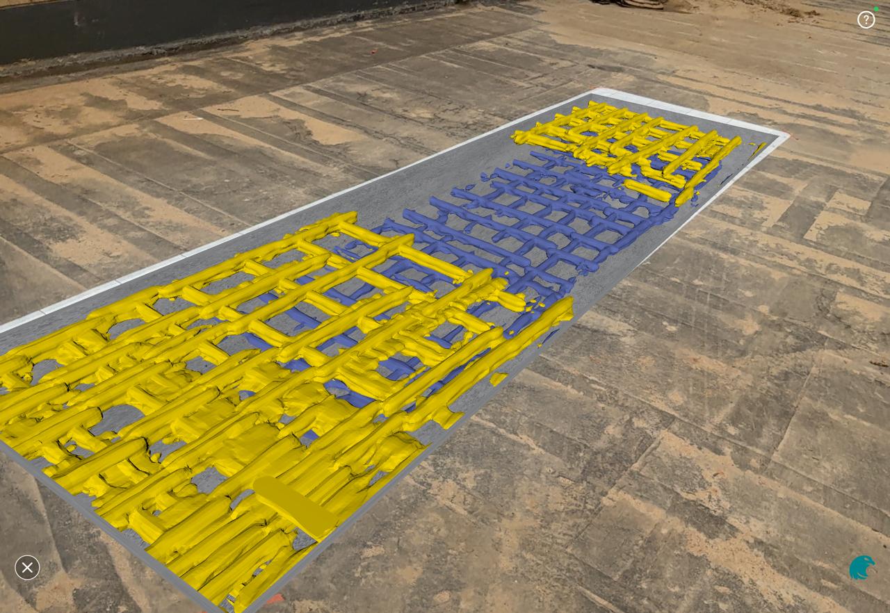
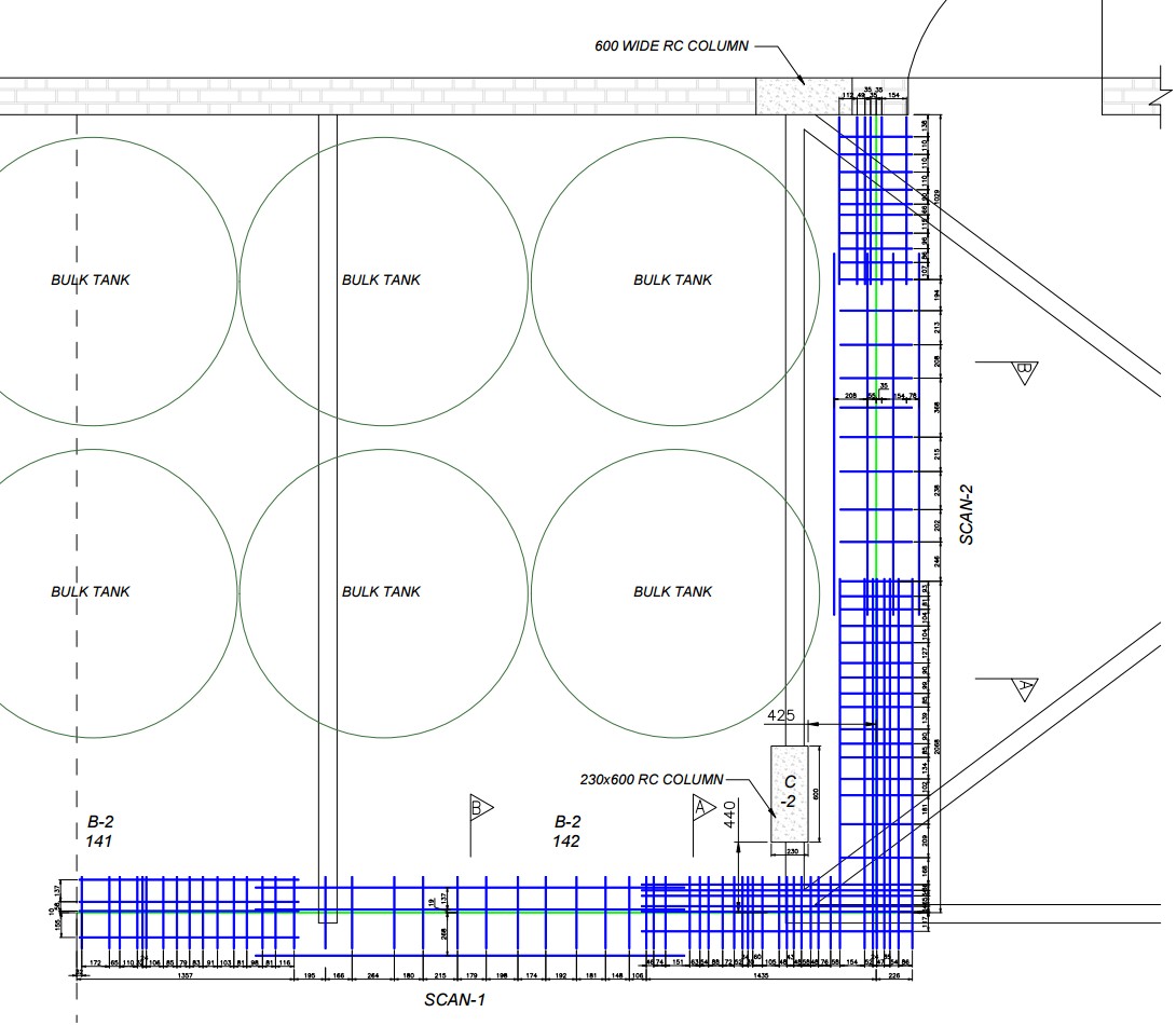
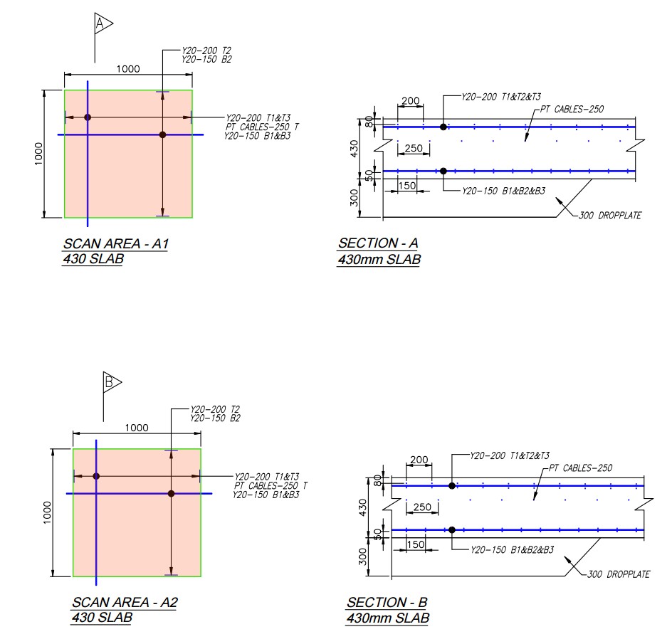
- Locate rebar, post-tension cables, metallic and non-metallic conduits embedded in concrete
- Create detailed scans of concrete floors, decks, columns, walls, & ceilings to detect embedded objects before cutting or coring.
- Detect voids in concrete & beneath slab.
- Core drilling & strength testing.
- Schmidt Hammer.
- CAD Reporting in bending schedule format with detailed layout & sections, 3D views, and site images


CONCRETE SCANNING WITH GPR
With new build construction and renovation projects, the likelihood of needing to cut or core a concrete slab is high. There is an inherent risk of striking rebar, electrical and communications conduits, and post tension cables during cutting, coring, or drilling process. The cost of such mistakes can be prohibitive.
Our well-trained, skilled, experienced technicians respond quickly to service requests, especially when your need for concrete scanning is a last-minute discovery.
The result is professional, accurate and timely scanning – the exact satisfaction you’re seeking to mitigate risk and keep your employees safe.
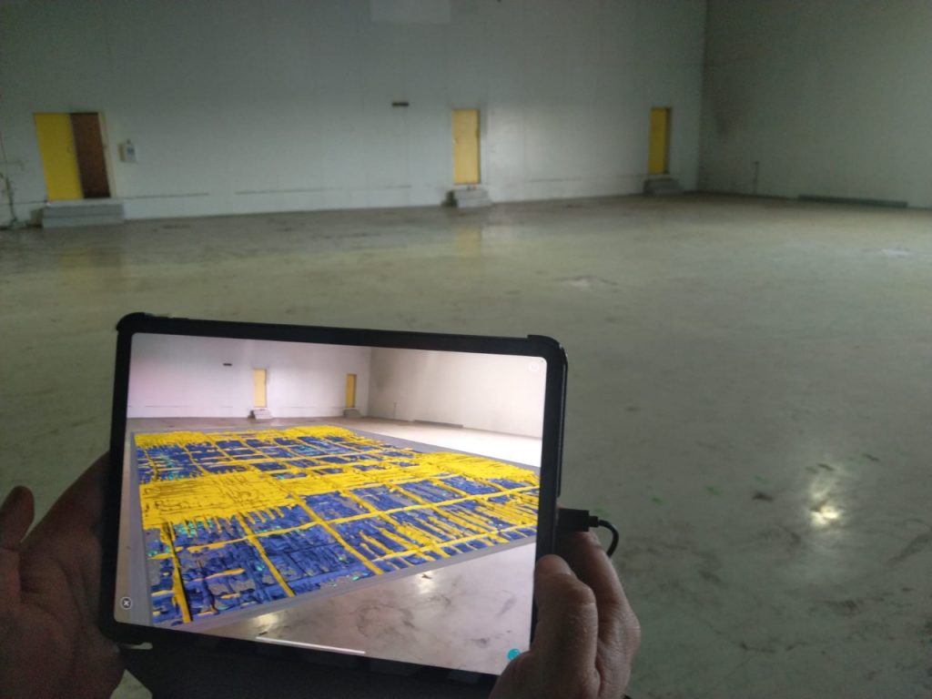
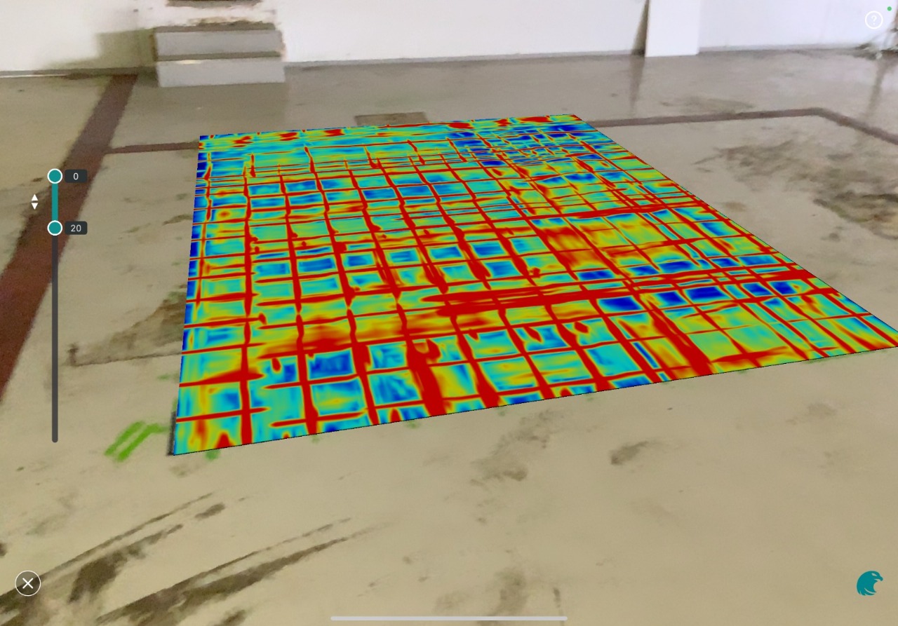
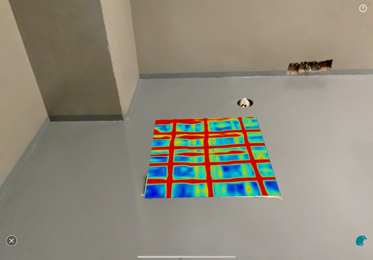
AUGMENTED REALITY – CONCRETE SCANNING
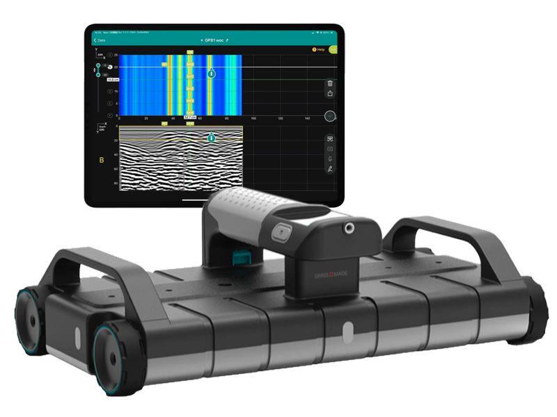
Proceq GPR Live is a ground-breaking GPR for the imaging of concrete structures. Proceq GPR allows real-time imaging that has been so far not thought possible. Proceq GPR Live is also the world’s first large-scale Augmented-Reality (AR)-empowered solution for industry applications.
In other words, you can now augment the world around you with GPR 2D and 3D visualizations that will merge seamlessly into the environment around you. The solution projects tomographic time-slice and 3D visualization into the environment around you by looking through an iPad. The result is a straightforward and intuitive visualization of measurements that radically facilitates data interpretation on-site.
EQUIPMENT
PROCEQ GP8100 FEATURES
- Push & Pull Wireless Cart – Versatility and Comfort.
- Stepped Frequencies – Continuous Wave GPR.
- Resolution & depth : Superior clarity of data at different depths thanks to the unique Swiss Made ultra wideband radar technology, optimized for small, closely spaced and deep targets alike.
- Versatility : Scan on flat or rough terrains, get real-time accurate GNSS positioning and adjust display settings in real -time for an optimal on-site interpretation of underground findings.
- User Experience : End-to-end workflows designed for experts and non-experts alike, from the most intuitive data acquisition to instantly shareable deliverables.
- Access your data from anywhere, anytime.
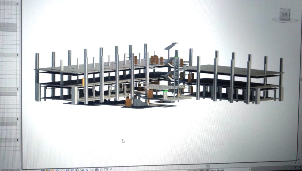
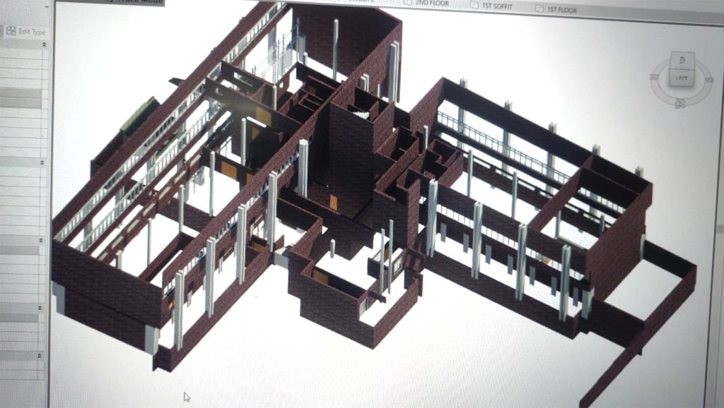
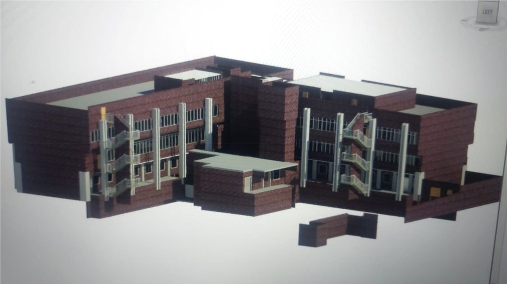
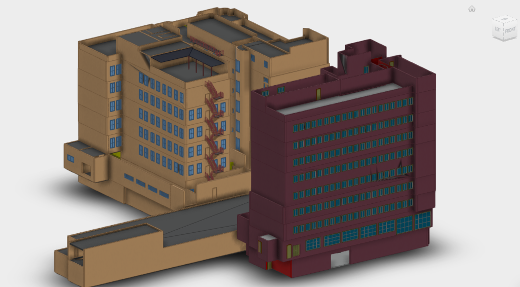
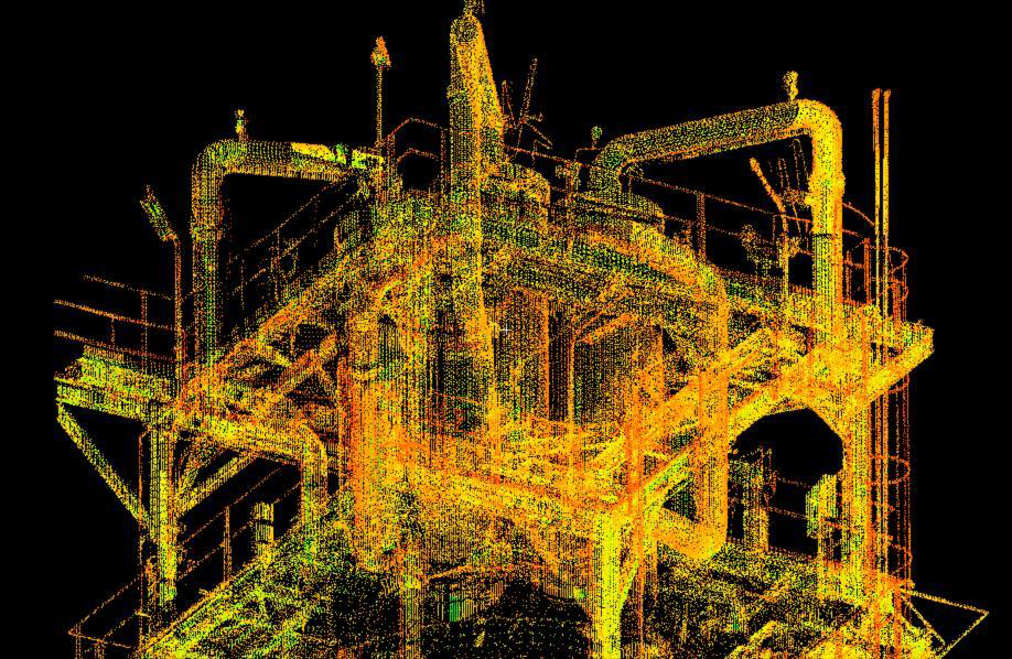
HDS 3D Laser Scanning & Modelling
High-Definition Surveying (HDS) is a precise, laser scanning method used to capture detailed 3D measurements of buildings, infrastructure, and terrain — both indoors and outdoors. Using terrestrial laser scanners, we scan multiple positions to generate millions of data points, known as a point cloud.
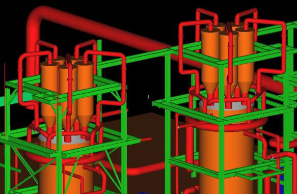
These point clouds are stitched together, cleaned, and used to build highly accurate 3D models and as-built plans. The technology captures everything the laser can “see,” including walls, doors, ceilings, HVAC systems, piping, and fixtures. From these scans, we create DWG CAD layout drawings, 3D BIM or Revit models, and even 360° panoramic photos.

Whether you need plans recreated from scratch, want to verify structural layouts, or require measurements for renovations or engineering projects — HDS delivers fast, accurate results. We scan in both local and geographical coordinate systems, using Hartebeesthoek94 (Lo zones) or UTM, depending on your site requirements.
Applications
- As-built recreation / Digital twin
- Renovation & structural alterations
- BIM & Revit modelling
- Volume calculations, tunnels, and mines
- Powerlines, plant layout, and road infrastructure
Deliverables
- Cleaned point cloud data
- DWG CAD drawings
- 3D Digital twin models in AutoCAD, Revit, or Cyclone
- 360° site photos and interactive viewing
- Survey reports for reference or submission
With various levels of modelling detail (LOD200 to LOD400), we tailor each scan to your project needs — from schematic engineering layouts to detailed architectural design ready models, view our gallery below of model samples.


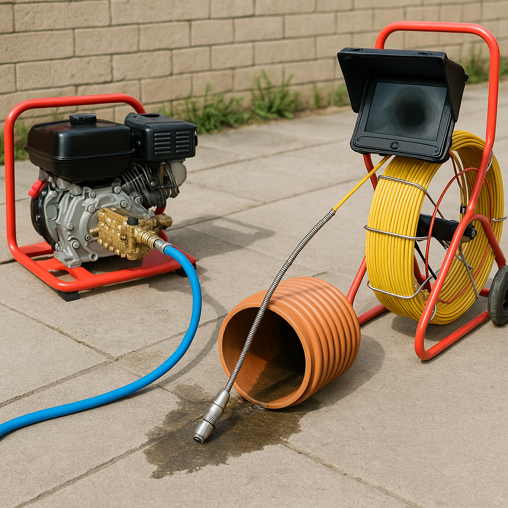
CCTV Pipe Inspections & Hydro Jetting
Our CCTV pipe inspection service offers a fast, accurate way to assess the internal condition of pipelines, drainage systems, and underground infrastructure. Using high-resolution camera systems, we inspect pipes from the inside — identifying blockages, cracks, root intrusion, collapsed sections, or structural damage without the need for excavation. This non-invasive method provides a clear view of problem areas and supports effective maintenance and repair planning.
In combination with inspections, we also offer hydro jetting — a powerful, high-pressure water cleaning method used to remove debris, grease build-up, roots, and other obstructions from pipes. Hydro jetting restores full pipe functionality and prevents future blockages, making it ideal for both reactive and routine maintenance.

Our combined CCTV and hydro jetting solution is suitable for:
- Sewer and stormwater lines
- Residential, commercial, and industrial plumbing
- Pre- and post-construction pipe condition reports
- Insurance or compliance inspections
Deliverables include:
- Digital video footage of the pipe condition
- Fault identification with timestamps and locations
- Maintenance recommendations
- Before-and-after jetting visuals (optional)
Whether you’re investigating a drainage issue or planning preventative maintenance, our service helps you diagnose and solve pipe problems quickly and cost-effectively.
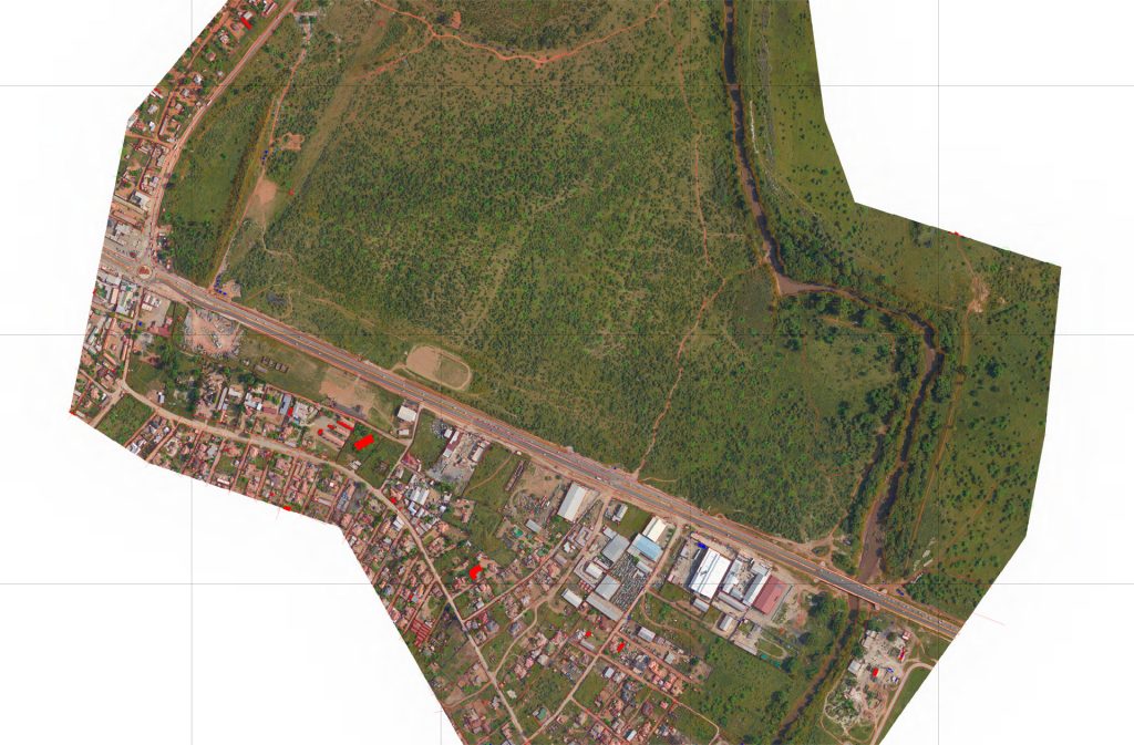
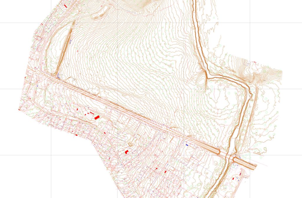
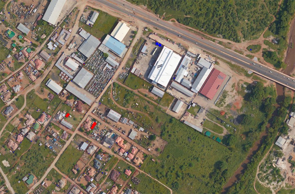
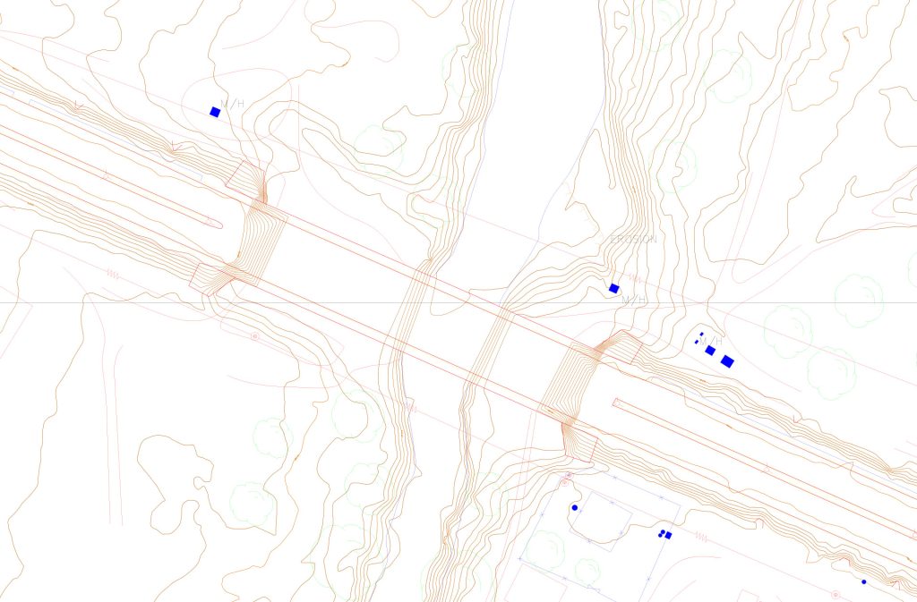
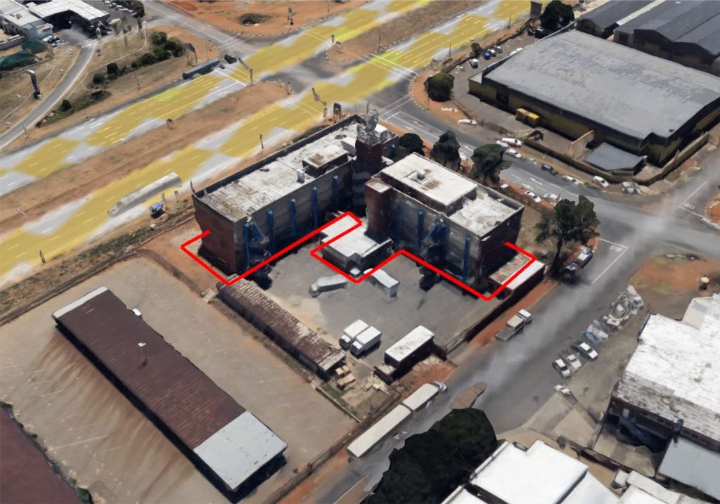
Aerial Drone LiDAR Survey & Mapping
Our Aerial Drone LiDAR (Light Detection and Ranging) survey service provides accurate, high-resolution 3D mapping of large or hard-to-reach areas. Mounted on unmanned aerial vehicles (drones), our LiDAR systems capture millions of precise measurements per second, creating detailed 3D point clouds of terrain, vegetation, and infrastructure. This allows for rapid and safe surveying of areas that would be difficult, dangerous, or time-consuming to access with traditional methods.
The collected data is processed to generate topographic maps, 3D models, and contour plans, which can be exported in formats suitable for CAD, GIS, or BIM applications. Drone LiDAR is ideal for:
- Land development and planning
- Infrastructure inspection (roads, bridges, railways, powerlines)
- Environmental and forestry surveys
- Volume calculations and stockpile measurements
Benefits include:
- Fast, non-intrusive data collection over large areas
- Highly accurate elevation and terrain information
- Integration with CAD, GIS, or BIM for design and analysis
- Safe surveying of difficult or hazardous sites


Our Drone LiDAR surveys provide clients with reliable, actionable data to inform planning, design, and decision-making, while reducing risk and site disruption.