NDT – “Non-destructive technology” as-built specialists
Unique SOP & DWG report.
Reinforcement locating
Post tension locating
Mapped in DWG layout
LIDAR structural scan & 3D model
Professional Scanning. Accurate Reporting. Smarter Decisions.
Advanced Scanning Solutions is a specialized service provider offering high-precision NDT scanning and inspection solutions for the architectural and engineering industries. We work closely with architects, engineers, and contractors to deliver accurate, non-destructive, non-invasive insights into structures and underground utilities.
Whether you’re working on a new build, a renovation project, or need structural clarity on existing design or infrastructure, our services are designed to reduce risk, improve safety, and speed up decision-making on site.

Our advanced scanning technology, including GPR and HDS laser scanning, gives architects and structural engineers accurate data on existing buildings and infrastructure. When no original plans are available, we recreate precise “as-built” drawings to work from. This enables safe design alterations, avoids damaging hidden elements like rebar or conduits, and streamlines the planning process. Whether you’re renovating, expanding, or investigating structural concerns, our scans give you the clarity needed to design with confidence.
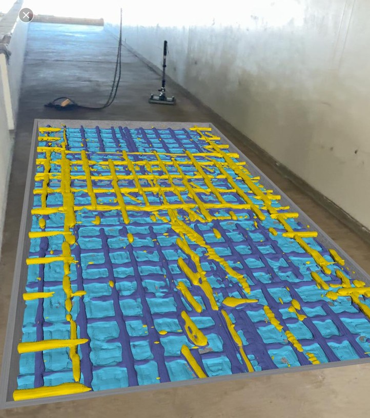
We use advanced Ground Penetrating Radar (GPR) technology, including the Proceq GP8100 system, to scan concrete structures and accurately detect and map:
Our scanning provides reliable insight before any drilling, cutting, or coring begins — reducing risk and avoiding costly errors. We also offer detailed 3D reports and Augmented Reality views, allowing on-site teams to visualise embedded elements using a mobile device. These scans are particularly valuable for architects and structural engineers needing accurate as-built documentation where no original plans exist.
read more...
High-Definition Surveying (HDS) captures millions of data points to create highly accurate 3D point clouds of interior and exterior spaces. This is essential for:
Data is aligned and converted into CAD-ready models, allowing design professionals to work from precise visual references. HDS is ideal for complex environments where manual measurement is impractical or inaccurate.
read more...
Our CCTV pipe inspection service uses high-resolution cameras to inspect the inside of pipelines and drainage systems. This allows us to identify & see in a full video and diagram report:
In conjunction with high-pressure hydro jetting, we offer a complete maintenance solution — clearing blockages, cleaning pipes, and restoring flow without excavation or major disruption.
read more...
Our Aerial Drone LiDAR survey service uses advanced aerial LiDAR technology to capture high-resolution 3D measurements of terrain, vegetation, and infrastructure. The data is processed into detailed point clouds and visual reports, allowing you to identify and measure:
The result is a comprehensive, actionable survey delivered in visual 3D models, topographic maps, and CAD or GIS-ready formats. Drone LiDAR provides a fast, safe, and non-intrusive method to survey large areas accurately, reducing the need for manual measurements or on-site risks.
read more...